
The historic record tell us that in 1191 William of Edington granted Brother Walter the Hermit ten acres of land ‘which his (Walter’s) predecessor enclosed with a ditch and as much pasture outside the ditch as he needs for his cattle’. He was also allowed two brethren, or more if resources permitted them. It was known at this time as the chapel of St Stephen, however by 1270 it was known as a priory and the brethren referred to as Augustinian Canons. Glastonbury abbey owned the estate, with the priory being the only building on Burtle Island until the dissolution in 1536.
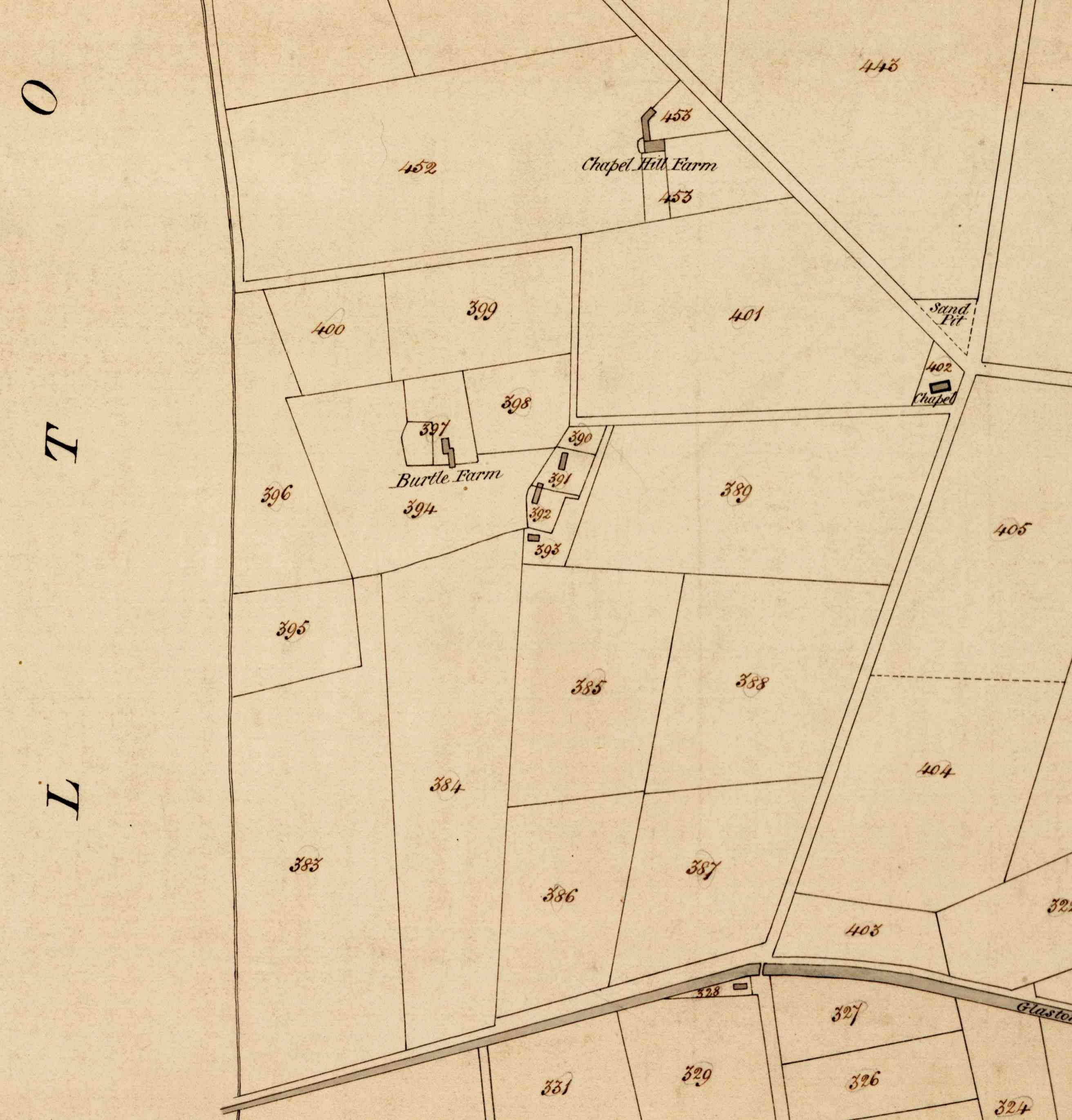
The Tithe Map showing the priory enclosure within the fields 394, 397 & 398.
Aerial photographs have shown ditches forming a trapezoid enclosure that probably represents that original grant of land to Brother Walter.
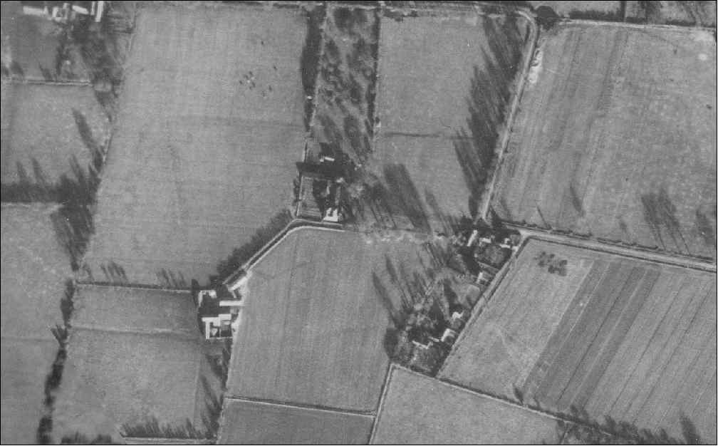
1940’s aerial photograph which shows the out field boundaries relating to the priory site.
A narrow electric cable trench through the enclosure produced pottery of 12th to 14th century date from six pits or ditches, in addition to traces of two graves. Dating of the bones suggests that one skeleton was probably that of one of the last monks buried there before the Priory was dissolved. Animal bones from the pits included cattle and sheep, but also mute swan and suckling pig, which hint at the rich diet enjoyed by those at the Priory.
